Data Snapshots
Data trends relating to our planning system at a glance
The Department of Infrastructure and Transport captures data and information that is considered by the state planning system, capturing changes in people, environment and urban form to provide all levels of government, industry and the community with the South Australian context that guides decision-making.
Click the boxes below to view snapshots, graphs and maps that summarise this data.
Housing ChoiceAccommodating changing, shrinking households
Housing Choice - Accommodating changing, shrinking households
About this snapshot
75% of new dwellings built in Metropolitan Adelaide are detached houses1. 77% of housing in Metropolitan Adelaide also comprises three or more bedrooms2.
In recent years, changing lifestyle choices and an ageing baby boomer generation have resulted in increasing trend towards alternative housing choices such as row houses, terrace houses, units and apartments. Planning reforms introduced in 2012 and 2013 to metropolitan Adelaide have seen a 400% increase in apartment approvals and a 60% increase in apartment sales3.
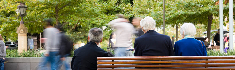
Currently, 61% of households contain only one or two persons3. Lone person households are the fastest growing household type and by 2031 are projected to increase by 44%4.
Our opportunity
We will support an increased trend towards alternative, 'missing middle' housing choices close to services and public transport to provide all South Australians access affordable living regardless of household type, life stage or lifestyle choice.
Further information
- 30-Year Plan for Greater Adelaide - Target 6: Greater Housing Choices
- Office of Design and Architecture South Australia - Draft Design Guidelines, Residential (Vol 1)
References
- 1 - DPTI, dwelling count data
- 2 - Australian Bureau of Statistics, 2016 Census of Population and Housing
- 3 - The Department of Planning, Transport and Infrastructure (2016)
- 4 - Australian Bureau of Statistics - 2016 Census of Population and Housing & 3236.0 - Household and Family Projections (released 19 March 2015)
Household and dwelling size, Metropolitan Adelaide
Data source: Australian Bureau of Statistics, 2016 Census of Population and Housing
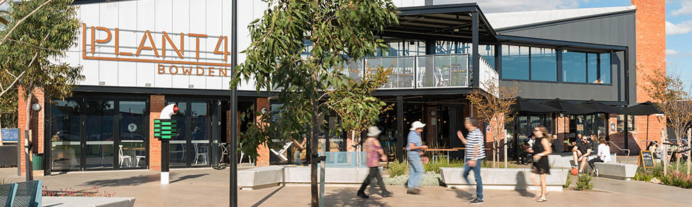
Living AffordabilityEnsuring affordable living in addition to affordable housing
Living Affordability - Ensuring affordable living in addition to affordable housing
About this snapshot
Greater Adelaide offers the second most affordable housing of any Australian capital city with a median dwelling price of $426,0001.
Greater Adelaide also offers affordable living options in areas close to high frequency public transport options. The middle ring of Greater Adelaide offers averages a total $924,000 20-year cost per household2. 40% of homes within Greater Adelaide are within 800 metres (10 minute walk) of high frequency public transport3.
Our opportunity
While Adelaide has a housing affordability advantage compared to other states, it is important to maintain living affordability in parallel as the costs of living extend beyond the purchase cost of the home to include transport, services and utilities costs. Transport costs are the second largest component of household expenditure and can be significantly higher for people living in the outer metropolitan areas compared to those living in inner and middle rim suburbs.
To reduce transport costs and to increase affordable living options, neighbourhoods should provide close and convenient access by foot, bike or public transport to local services, shops, primary schools and public open space
Further information
References
- 1 - Core Logic (2017), Core Logic Index
- 2 - DPTI (2017), The 30-Year Plan for Greater Adelaide
- 3 - Infraplan (2013), Urban Infill vs Greenfield Development; A review of economic benefits and costs for Adelaide
Median dwelling prices in Australian capital cities, 2017
Data source: Core Logic (2017), Core Logic Index
Total 20 year cost per household in Greater Adelaide
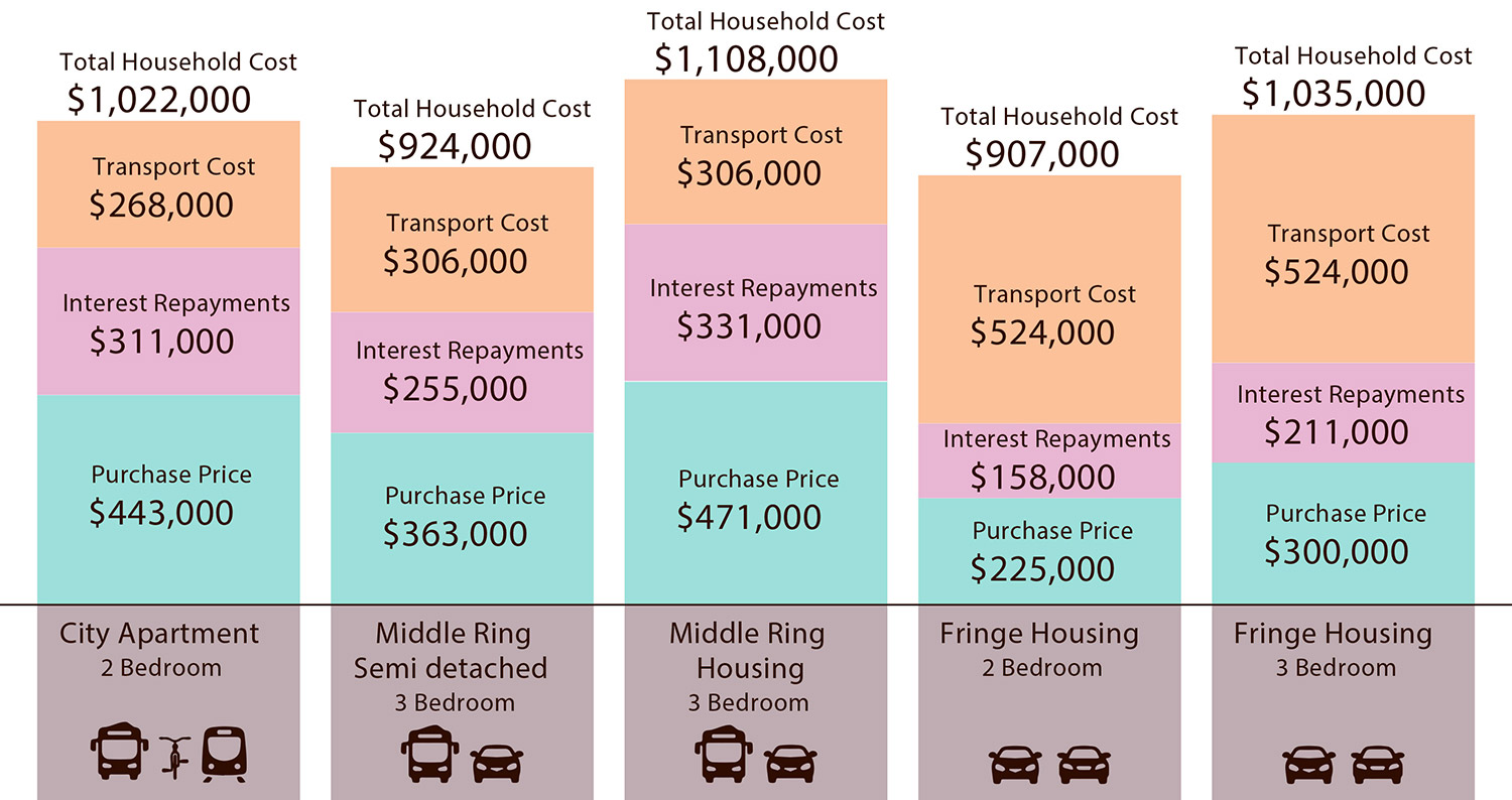
Data source: Infraplan (2013), Urban Infill vs Greenfield Development; A review of economic benefits and costs for Adelaide
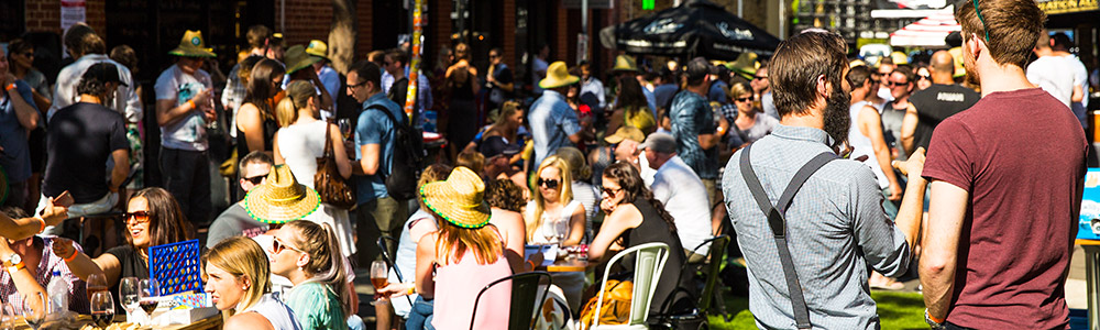
Public Open SpaceBecoming more important the more we grow
Public Open Space - Becoming more important the more we grow
About this snapshot
Quality public open spaces connect people with nature, encourage walking and cycling, and are great places for people to meet and enjoy. 77% of residents in Greater Adelaide live within 400 metres (5 minute walk) of public open space that is greater than 4,000m²1.
The Adelaide CBD is surrounded by 930 hectares of Park Lands which are the largest urban park system in the nation2. The State Government have committed $20 million over four years for Park Lands revitalisation projects to ensure the Park Lands are attractive, diverse, resilient and vibrant for existing and future communities that surround them.
Our opportunity
As living and housing choices in Greater Adelaide change, the role of public open space becomes more important as more people choose to live in places with smaller backyards such as apartments or units. Ensuring access to quality green spaces and places for recreation, health and wellbeing is vital.
The Adelaide Park Lands will become the new backyards for people living along the city’s edge and will support an increased population in the city.
Streets represent approximately 80% of public open space in modern cities and must be recognised as destinations for commercial activity and social interaction, not just as transportation routes dominated by cars3. Green infrastructure is essential on streets to prioritise people instead of vehicles.
Further information
- Planning and Development Fund
- Adelaide Park Lands (City of Adelaide)
- Adelaide Park Lands Upgrade (Renewal SA)
References
- 1,3 - DPTI (2017), The 30-Year Plan for Greater Adelaide
- 2 - City of Adelaide (2017), Adelaide Park Lands
Planning and Development Fund public realm investments 2010-16
Planning and Development Fund public realm investments 2015-16
Data source: DPTI (2016), Planning and Development Fund
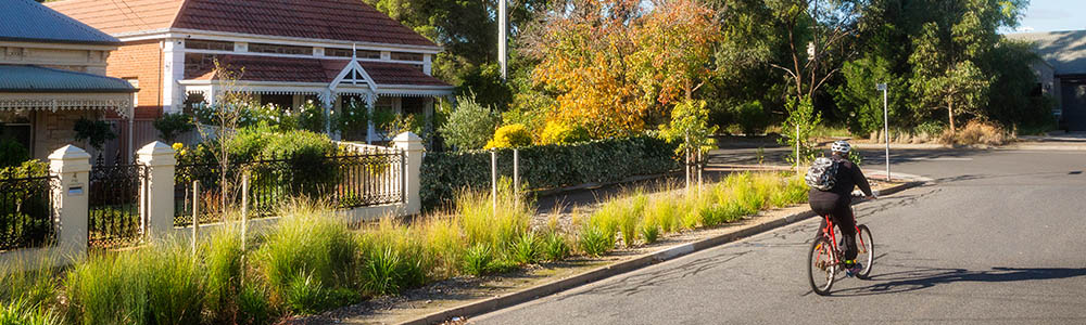
Active Travel Allowing for affordable travel options and a healthy lifestyle
Active Travel - Allowing for affordable travel options and a healthy lifestyle
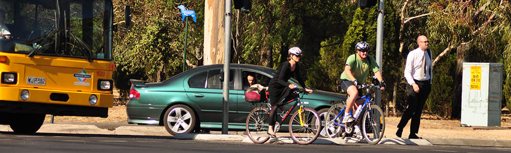
About this snapshot
Active travel to destinations is a convenient, accessible and highly effective way to integrate exercise into the work day. Active travel includes walking, cycling, skating and skateboarding. Public transport can also be included if the method of travel to the station or stop was by active travel and not a private vehicle.
80% of travel in Greater Adelaide is made by private vehicle use as either a driver or passenger. Currently, 14% of people in Greater Adelaide use active travel methods in their journey to work1.
72-75% of people in Greater Adelaide have a trip destination within the same area from where they start, averaging a short trip distance of 3-6 kilometres. The average person is expected to be able to cycle this distance in 9-18 minutes2 which is a perfect opportunity to utilise active travel.
Active travel saves the Australian economy $1.43 billion a year, providing a benefit of $1.43 for every kilometre cycled and $2.12 for every kilometre walked3.
Our opportunity
There is great potential for increasing active travel modes in the Greater Adelaide region, particularly in areas close to the city and/or high frequency public transport options. Replacing car use with active travel reduces congestion on our roads, improves air quality and significantly reduces individual transport costs.
Further information
References
- 1 - Australian Bureau of Statistics (2011), Census of Population and Housing
- 2 - Department of Planning, Transport and Infrastructure (2015), Integrated Transport and Land Use Plan Technical Document
- 3 - Australian Government (2013), Walking, Riding and Access to Public Transport
Maps of method of travel to work (walking, cycling or public transport) by suburb of origin, South Australia
Population GrowthAccommodating growth and new South Australians
Population Growth - Accommodating growth and new South Australians
About this snapshot
There are approximately 1.7 million people living in South Australia. Over the five years to 2016, South Australia's average annual growth rate has been 0.9% (approximately 14,700 people per year). 83% of South Australians, some 1.4 million people, live in the Greater Adelaide Planning Region1.
South Australia’s population is projected to reach 2 million people by 2036. 96% of this growth is projected to be in the Greater Adelaide Planning Region.
Our opportunity
We will continue to attract international and interstate people to live, work and play in South Australia to continue to support our state economy.
Further information
References
- 1 - ABS 3218.0 - Regional Population Growth, Australia (released 28 July 2017)
Projected Population, South Australia, 2016-36
Data source: DPTI Population Projections (medium series) September 2015 release
Map of projected population, South Australia, 2016 and 2031
Data source: DPTI Population Projections (medium series) September 2015 release
Housing GrowthEncouraging new dwellings in planned growth areas
Housing Growth - Encouraging new dwellings in planned growth areas
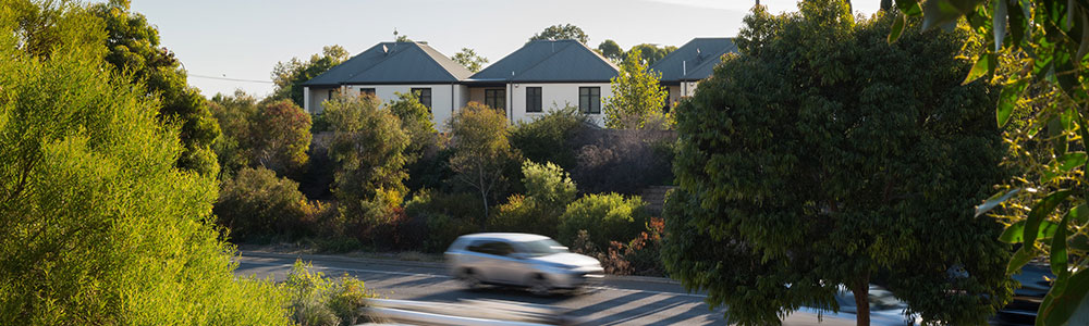
About this snapshot
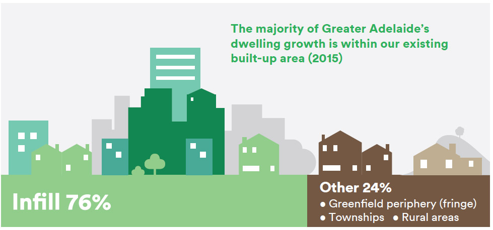
Between 2010 and 2015, 76% of new dwellings in the Greater Adelaide region were built in existing built-up, infill areas rather than on broadhectare land on the fringe. This met our 2010 30-Year Plan for Greater Adelaide target for infill development earlier than expected1.
Infill development in the inner and middle suburbs of Adelaide encourages greater use of our public transport system, utilises existing infrastructure and generates more jobs than building new homes on the fringe2. Areas in Adelaide with higher population densities are some of our most vibrant and liveable communities such as Unley, Prospect, Glenelg and Norwood.
Our opportunity
We will continue to encourage growth within our existing urban footprint as infill development with convenient access to public transport. We will also encourage diverse housing types to provide equal opportunity to all South Australians.
Further information
- Land supply monitoring (DPTI)
- The 30-Year Plan for Greater Adelaide - Target 1: Containing our urban footprint and protecting our resources
References
- 1 - DPTI (2017), The 30-Year Plan for Greater Adelaide
- 2 - Infraplan (2013)
Map of dwelling density (dwellings per km²) in Greater Adelaide by suburb, 2006 & 2016
Data source: DPTI (2017), Dwelling count data derived from DCDB/Valuation data
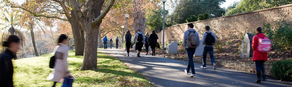
NeighbourhoodsCreating healthy, walkable and affordable places to live
Neighbourhoods - Creating healthy, walkable and affordable places to live
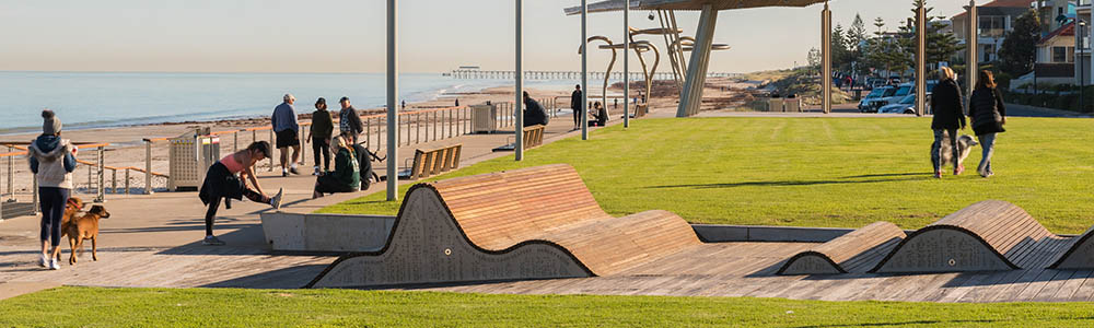
About this snapshot
Healthy, walkable neighbourhoods are where the daily needs of most residents can be met within a short trip of where they live or work, accessible by foot, bike or public transport. Currently, 52% of the population of Greater Adelaide live within walkable neighbourhoods with close access to jobs, shopping, learning, open space, recreation, and other amenities and services1.
Tree canopy cover is an essential part of a healthy neighbourhood and people who live in with a higher density of trees on their streets perceive themselves to be significantly healthier and have fewer cardio-metabolic conditions2. Greater Adelaide has an average tree canopy cover of 27.28%3.
Our opportunity
Creating communities where people can live nearby to their daily needs is essential to supporting increases in walking, cycling and public transport.
To create vibrant neighbourhoods we will ensure there are enough people to support local shops, services, public transport and community facilities within walking distance. The increased presence of people gathering, walking, or riding bikes on streets helps to improve the amenity value of these spaces and increases feelings of personal safety or security.
Further information
- The 30-Year Plan for Greater Adelaide - Target 4: Walkable Neighbourhoods
- The 30-Year Plan for Greater Adelaide - Target 5: A Greener City
- Seven Strategic Priorities – Safe communities, healthy neighbourhoods
References
- 1,2 - DPTI (2017), The 30-Year Plan for Greater Adelaide
- 3 - Institute of Sustainable Future, University of Technology Sydney (2014), National Benchmarking Report.
Ingredients of a healthy neighbourhood
Data source: DPTI (2017), The 30-Year Plan for Greater Adelaide
DemographicsSupporting our changing and ageing population
Demographics - Supporting our changing and ageing population
About this snapshot
South Australia has the second oldest population in Australia with a median age of 40 and 18% of the population aged 65+1. By 2041, this cohort of South Australians is projected to increase by 170,000 people and account for 23% of the population2.
59% of net interstate migration losses is comprised of 20-39 year olds which also contributes to an ageing population3.
Our opportunity
We will provide greater housing and transport choices to suit the changing needs of our population and provide incentives for young people to stay, live and work in South Australia.
Further information
References
- 1 - ABS 3101.0 – Australian Demographic Statistics (released 22 March 2018)
- 2 - DPTI population projections (medium series) (released September 2015 and February 2016)
- 3 - ABS 3412.0 – Migration Australia, 2015-16 (released 30 March 2017)
Percent Change in Projected Population by Age Group, South Australia, 2016-41
Data source: DPTI population projections (medium series) (released September 2015 and February 2016)
Projected populated aged 65+ in South Australia, 2016 and 2031
Data source: DPTI population projections (medium series) (released September 2015 and February 2016)
Greater AdelaideThe engine room of South Australia's economy
Greater Adelaide - The engine room of South Australia's economy
About this snapshot
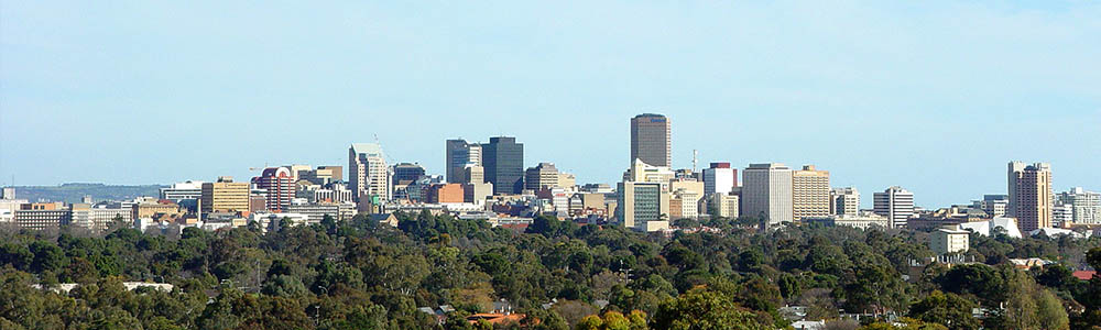
The Greater Adelaide planning region stretches from Victor Harbor to Kapunda and includes an area of approximately 9,000 km². 84% (1.4 million people) of South Australians live in the Greater Adelaide Planning Region and by 2031, 97% of South Australia’s population growth is expected to occur here1.
Greater Adelaide is South Australia’s engine room, contributing more than 80% of the State’s Gross State Product (GSP)2. There are 523,000 jobs in Greater Adelaide which accounts for 73% of South Australia's workforce3.
Our opportunity
We need to plan for significantly more people, dwellings and jobs in Greater Adelaide to support South Australia’s future growth.
Further information
References
- 1 - ABS 3218.0 - Regional Population Growth, Australia (released 30 March 2017) & DPTI Population Projections (medium series) September 2015 release
- 2 - Department of Planning, Transport and Infrastructure (2017), The 30-Year Plan for Greater Adelaide
- 3 - Australian Bureau of Statistics (2011), Census of Population and Housing
Map of job density per km² in the Greater Adelaide region
Data source: Australian Bureau of Statistics (2011), Census of Population and Housing
Land SupplyProviding enough land for future growth
Land Supply - Providing enough land for future growth
About this snapshot
In recent years, the amount of broadhectare land consumed for new dwellings has lessened. Between 2010 and 2015, 76% of new dwellings in the Greater Adelaide region were built in existing built-up, infill areas rather than on broadhectare land on the fringe1.
There is currently over 20 years' worth of zoned land available for future growth from the combination of broadhectare land and significant infill areas in the Greater Adelaide region2.
Our opportunity
We will continue to encourage new development within built-up areas to avoid urban sprawl, incur less transport and infrastructure costs for South Australians and support South Australia’s long-term growth.
Land available in the right places and at the right time provides certainty to the property industry, stabilises land markets, supports population growth, and nurtures sustainable and healthy communities through the provision of a range of housing options
Further information
- Land supply monitoring
- 30-Year Plan for Greater Adelaide – Target 1: Containing our urban footprint and protecting our resources
References
- 1 - DPTI (2017), The 30-Year Plan for Greater Adelaide
- 2 - DPTI (2015), Residential broadhectare land supply report - Greater Adelaide region and selected rural townships
Greater Adelaide and rural townships broadhectare land consumption
Data source: DPTI (2016)
Residential infill ratio in Greater Adelaide
Data source: DPTI (2015)
While every effort has been made to ensure data is correct, up-to-date and consistent, DIT gives no warranty in relation to the data and accepts no liability for any loss, damage or costs resulting from the data being inaccurate or incomplete in any way and for any reason.